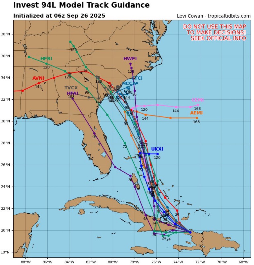
Friday morning brought new updates on the tropical disturbance currently being tracked as Invest 94L. The system is expected to become a tropical depression over the weekend as it moves near the Bahamas. If it strengthens, it will take the name Imelda.
As of 8 a.m. Friday, the National Hurricane Center gives this disturbance a 90% chance of development within the next seven days. Showers and thunderstorms are becoming more organized near Hispaniola and eastern Cuba, and heavy rains are likely to impact the Bahamas and eastern Cuba over the next day or two.
If this storm tracks toward Georgia or South Carolina, the most likely window for impacts is Monday through Wednesday (Sept. 29 – Oct. 1). That could include heavy rain, gusty winds, and rough surf, even if the center stays just offshore. Watches and warnings may be issued as early as this weekend.
It’s still too early to pin down exact strength for Savannah, but here’s what the models show as of Friday morning:
The takeaway: Savannah should prepare for the potential of a strong tropical storm or low-end hurricane, but confidence in exact intensity won’t improve until the system organizes this weekend.
We’ll keep updating this page with the latest forecasts through the weekend. Check back for fresh model runs and National Hurricane Center updates as the track and intensity become clearer.